What is the Blueprint for the Culm?
Creating a 25-year vision for the River Culm and its catchment
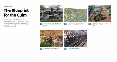
The Blueprint for the Culm is a 25-year management plan that aims to guide and inform all investment decisions in the River Culm Catchment.
This page describes how we developed the Blueprint. Click here for the full Blueprint Action Plan with interactive maps.
How was the Blueprint for the Culm developed?
The Blueprint was developed through a collaborative process involving residents, community organisations, businesses and statutory authorities so that it could be informed by those affected by its activities and outcomes, and secure their support.
We began in June 2020 by gathering evidence, discussing ideas and consulting organisations and individuals across the catchment, to build up a picture of how the River Culm is performing, consult on our vision and develop our Action Plan. We initially established several Working Groups and organised a series of Catchment Adaptation Workshops to explore the different themes of the project. Throughout, we have taken an inclusive approach to involve local people in the process.
Next, we developed a vision statement that captures the future we want to create. This is:
The River Culm will be celebrated as a lifeline that connects people with each other and with nature. Land across the catchment will be managed to protect and enhance the River, whilst sustaining people’s livelihoods. Throughout the seasons and as the climate changes, the River Culm will have space to flow naturally and safely. The water will run clear, wildlife will flourish, and people will easily access and enjoy all of these benefits.
In 2021 we developed the key actions needed to realise this vision. We shared these at our Forum on 17 November 2021
Read more about the Action Plan themes and priority actions
Next we developed “SMART” (Specific, Measurable, Achievable, Realistic and Timely) targets that we are using to drive and monitor these actions, working with agencies and funders to see how these align with their own priorities. We shared these at our Forum in November 2022.
How could the Blueprint change the Culm catchment?
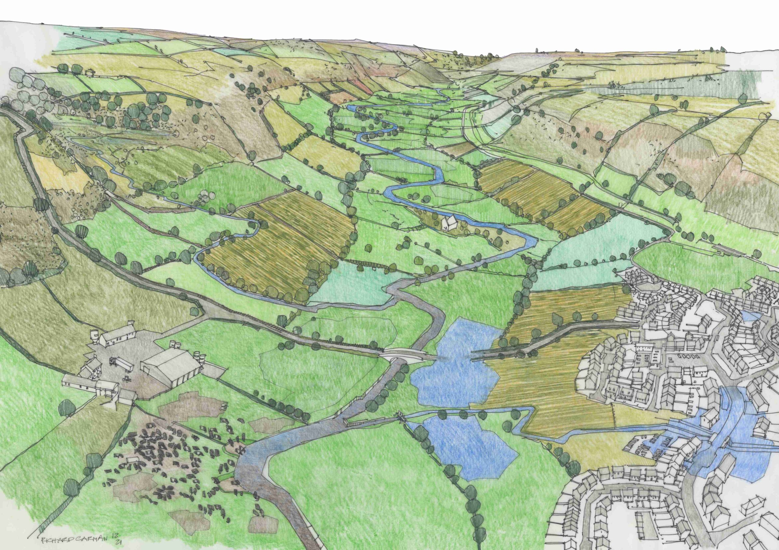
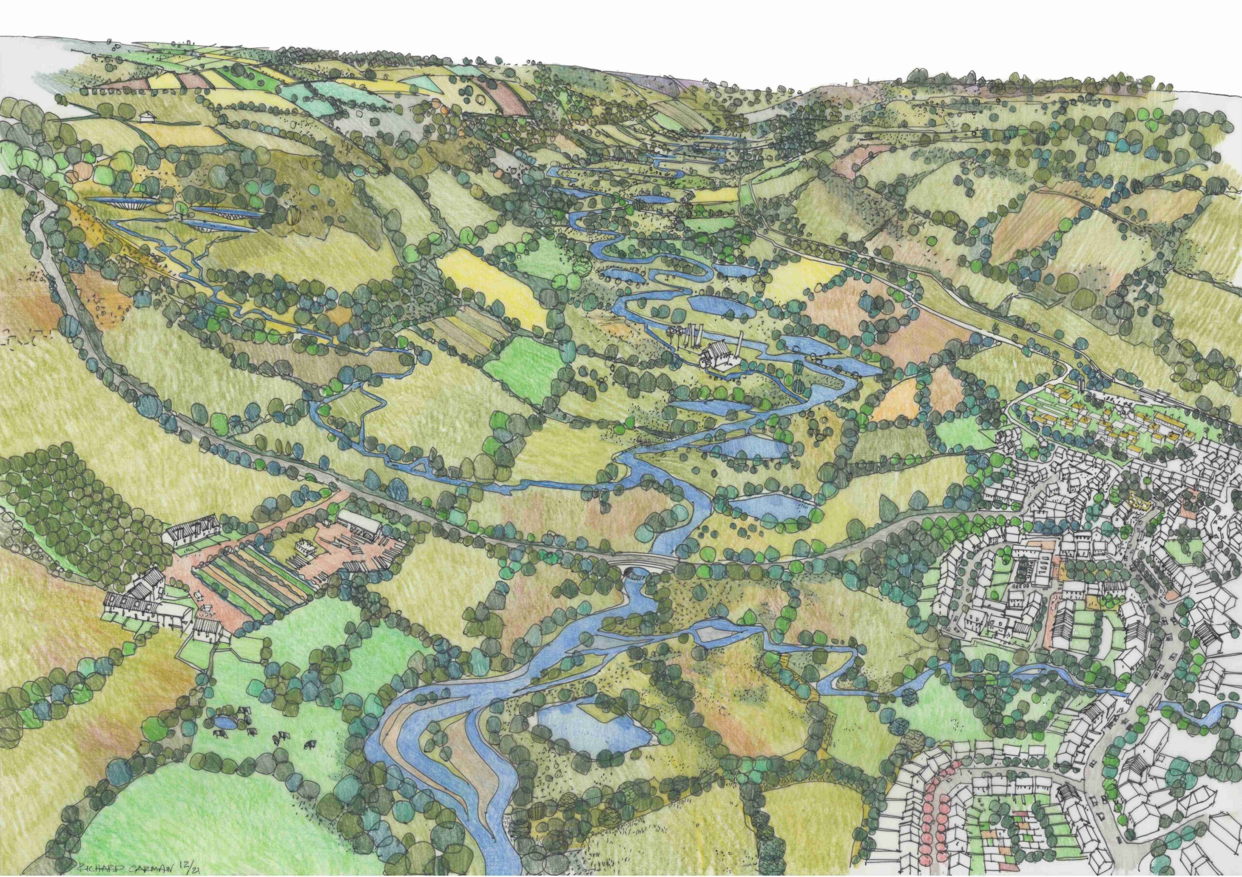
The image below (produced by local artist Richard Carman) shows how the landscape could change to realise this vision. Drag the bar across from right to left to travel from the present day to 2050.
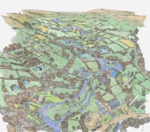
These images were developed from a previous set which we have preserved below – if you visit the Thinglink versions you can explore the features in more detail.
The first is of the Upper Culm in 2050 in summer (Thinglink version):

The second is of the Culm Floodplain in 2050 in winter (Thinglink version):
Key features of these landscapes to note are:
- more trees in the landscape
- a patchwork of smaller fields and thicker hedgerows
- more land making space for nature
- more local food growing with care for nature
- more ponds and wetlands
- crystal-clear waters
- more access to and along the river
- outdoor activities and learning
- homes built away from the floodplain
- homes built using local, sustainable materials
- space allowed for flooding to happen safely
- beavers helping slow the flow
- more energy generated locally
- green transport solutions
The Blueprint is based on the latest science
We are undertaking detailed scientific research into the health and function of the river.
We have developed a comprehensive Environmental Evidence Review for the Culm and this can be downloaded from our Library by clicking the button below. It brings together all the available data for the Culm from a wide range of sources including land use and landscape, water quality, wildlife habitats, soils, flood and drought risk and heritage assets. This information underpins the Blueprint and will help us make the right decisions as we go along.

An extract from the Environmental Evidence Review, showing water quality data from all the main watercourses in the catchment.