
The last four weeks have seen a flurry of activity across the Culm catchment as our first round of working groups got underway. At each session, after quick introductions, we got down to exploring issues and ideas, using the Google Map to capture things spatially and keeping a record of the discussions on our Google Drive.
It all started with the Trees for the Culm Workshop on 19 January, after which several stalwarts, including Jon Burgess of the Forestry Commission, stayed on for a first meeting of the Nature-Based Solutions group. We explored tree-related issues including how trees affect the value of farmland and how we can ensure trees are planted in the right place. There was interest in holding a separate session to look at carbon credits, how they work and how landowners can benefit from them. The group felt that holding a Working Group straight after a Workshop was not something to repeat, as everyone’s energy was flagging a bit after over 3 hours of Zoom! – so from now on we’ll hold them separately.
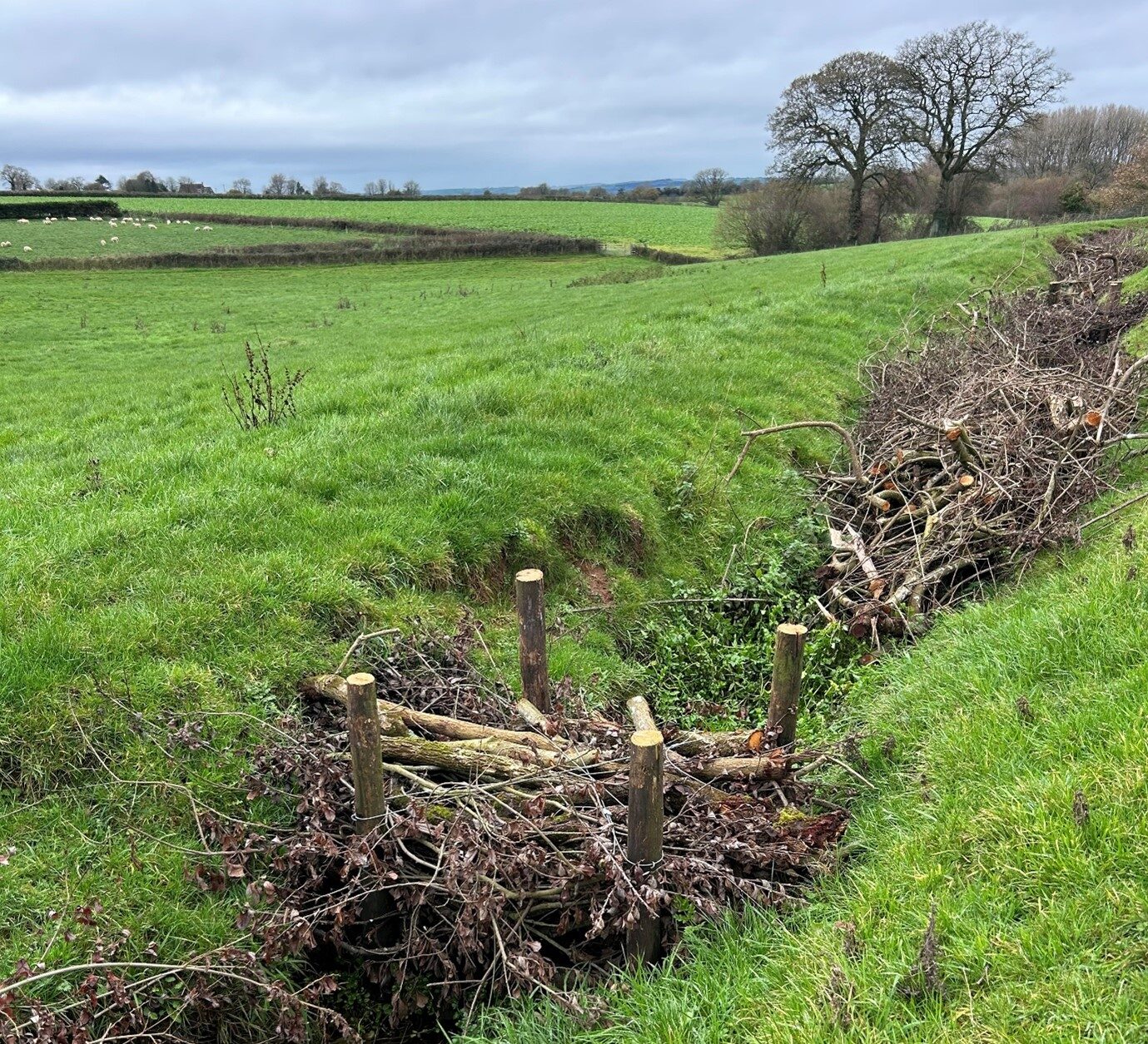
Next up was the Upper Culm, where we looked at plans that Daniel Halford, our Farm Advisor, has developed with two farms near Hemyock, to install nature-based solutions as demonstration sites. We also discussed locations where the Culm is eroding banks severely and local flooding ‘wet-spots’; potential input by apprentices through Bridgwater College and by local volunteer groups; issues with siltation and how that is dealt with; involving young people; wildlife surveying and invasive species like Himalayan balsam.
Proposals for Deadbeer Farm, above Hemyock, to be funded by Connecting the Culm.

At the Mid-Culm session the issue of siltation came up again, with concerns about the lack of dredging of the river (NB, this is an important issue we need to discuss in more detail, and we hope to organise a site visit with a rivers expert to explore it later this year). Mark Baker from the Grand Western Canal talked about how soil erosion upstream affects the canal, especially as it doesn’t have moving water to clear sediments through the system. We went on to discuss maize growing and how that can lead to soil erosion, and the role of the anaerobic digesters in the area. Other topics included the need for an off-road link between Willand and Uffculme; coordinating between parish council Neighbourhood Plans; and the potential impact of the Culm Garden Village.
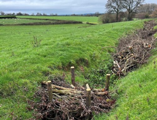
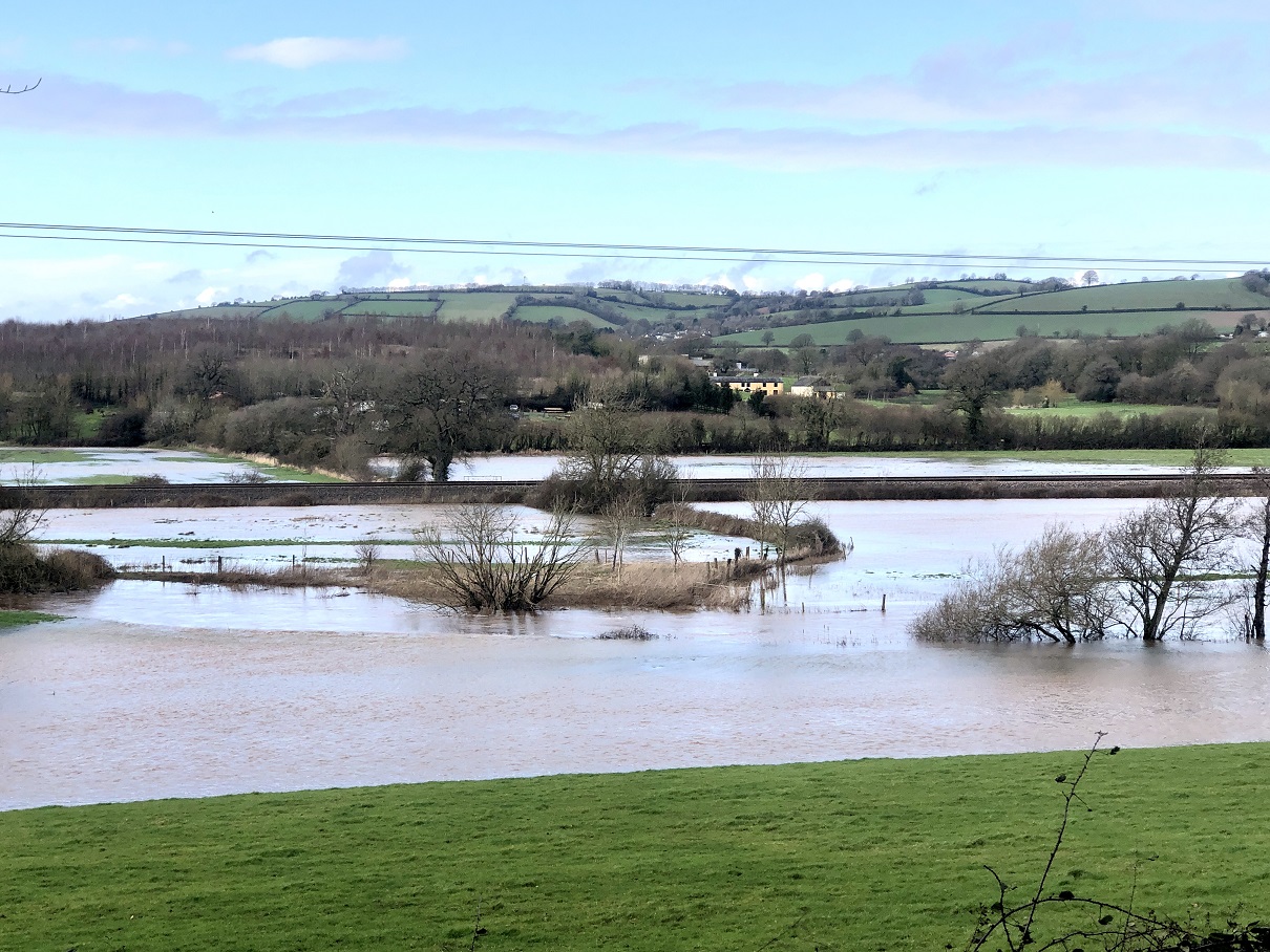
The Lower Culm meeting discussed tree clearance alongside the river and the benefits and dis-benefits of this – another topic for future detailed exploration! We also looked at flooding vulnerability in Stoke Canon, opportunities for access to the river in the area and interest in researching local field names connected to the river.
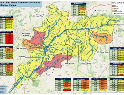
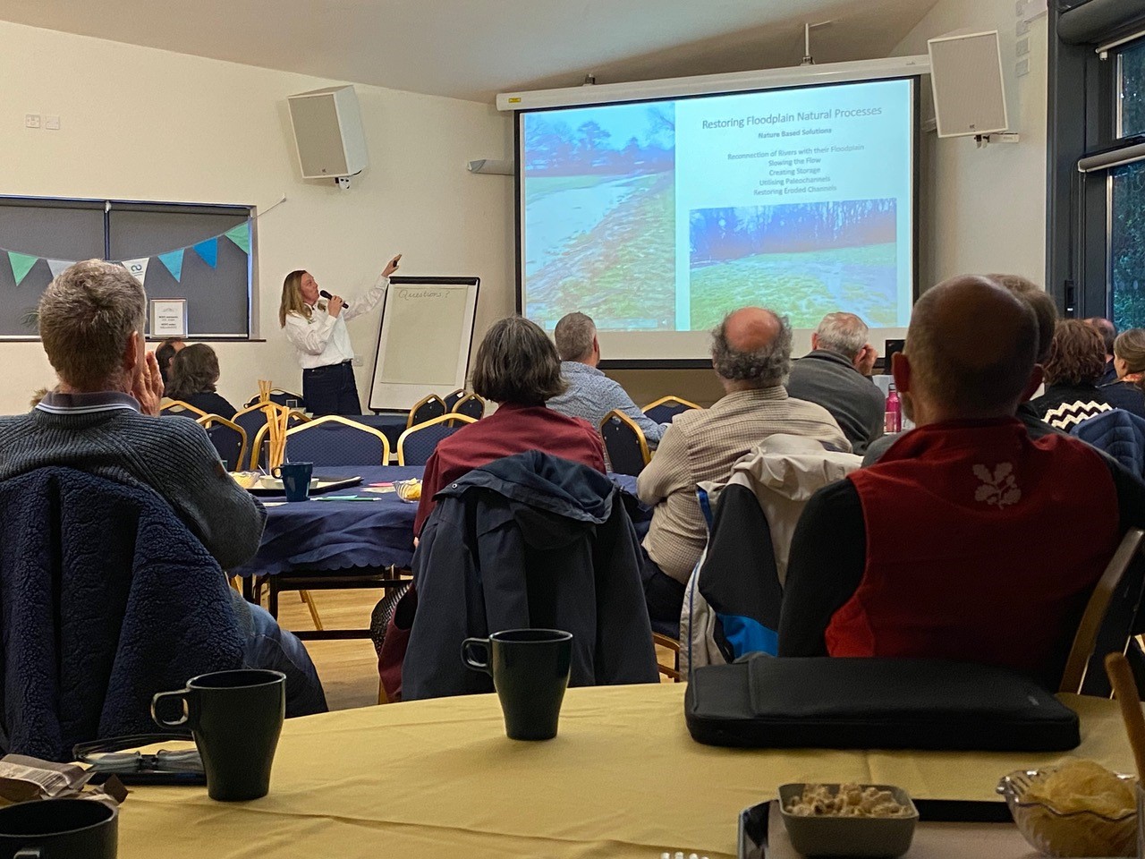
The next session was on the theme of Water Quality. We were joined by several experts in their field: Simon Browning and Lydia Deacon of the Citizen Science Investigations (CSI) team from Westcountry Rivers Trust (WRT); Richard Horrocks who runs the Riverfly Scheme for the Culm; and Dan Griffiths, a water quality specialist at the Environment Agency. We discussed the success of the CSI scheme on the Culm, with 14 active surveyors, and how this fits in with Riverfly. Simon showed us the new “sonde” that WRT will be installing in the Lower Culm to provide live measurement of water quality which will provide a fascinating new data set and allow us to monitor water quality in much greater detail.
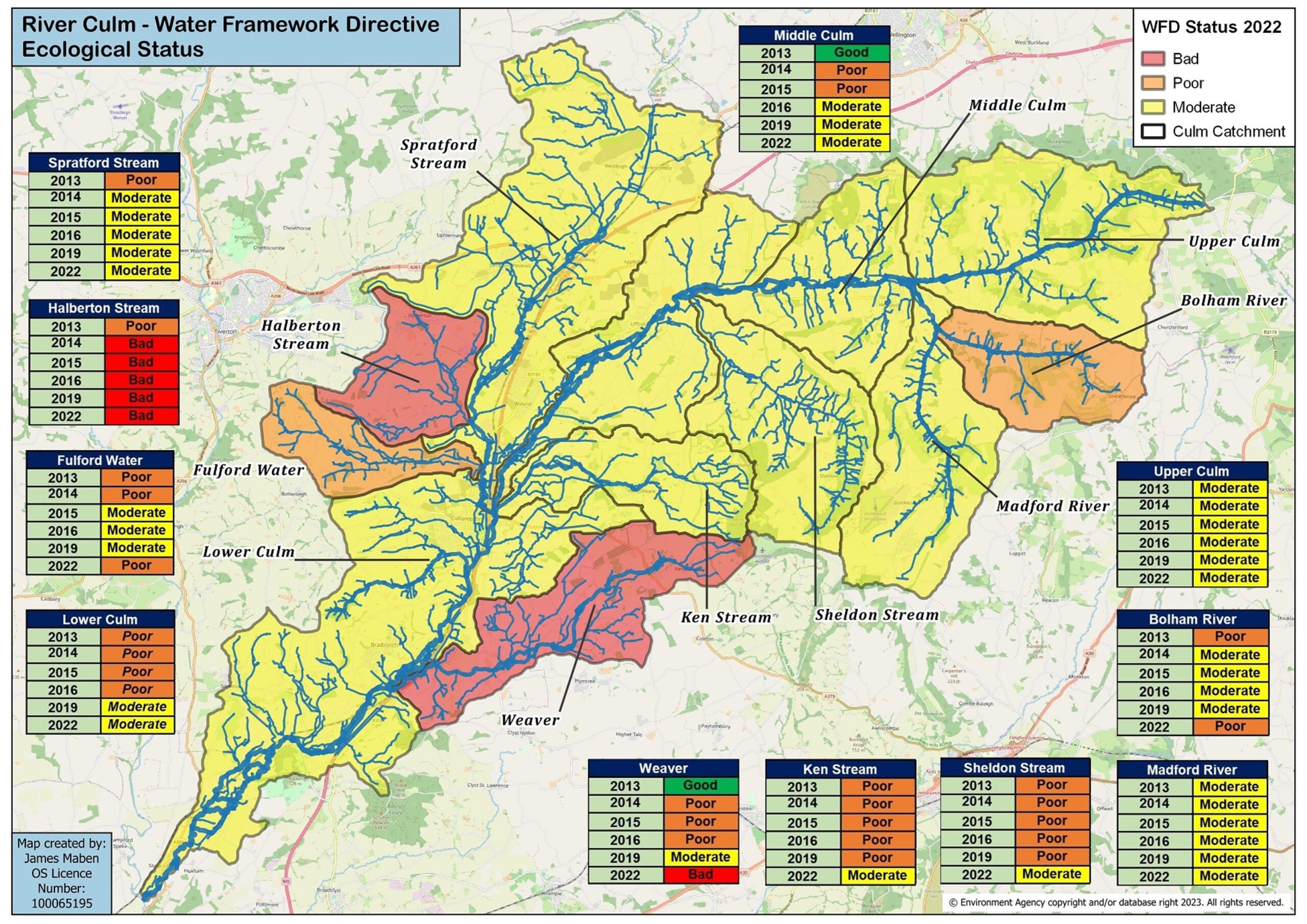
Richard talked about the drastic loss of fish in the river over the last 10-15 years and shared Riverfly data showing that phosphate levels are consistently well above limits throughout the mid- to lower Culm, although above Hemyock and on the Madford readings are very low. We discussed the role of septic tanks and sewage treatment works in phosphates, and how much these “point sources” compare with diffuse pollution sources such as agricultural run-off in polluting the river and looked at the project Evidence Review which shows around 75% of the phosphates come from agricultural sources.
Finally, in the Access group, we discussed how the Connecting the Culm project, with its focus on working with nature to adapt to climate change impacts, wasn’t designed as an access project. However, interest from the community in access had been so strong, and it was clear that we need to look at improving links between people and the river wherever possible, if we can do so alongside our nature-based work. This could focus on connecting our priority areas to main towns / villages. Land owner support would always be a critical factor and the costs of implementing new routes could be high. But the need for better sustainable foot and cycle links between communities was now stronger than ever and funding will hopefully be forthcoming, especially if we can develop an overall plan through the Blueprint (similar to the Clyst Valley Regional Park). The Willand to Uffculme link was high on the agenda but other links included Willand to Cullompton (which the Garden Village should be able to help realise), Culmstock to Hemyock, and Bradninch to Cullompton.
Round Two of the Working Groups kicks off soon, so please add any of the following meetings that interest you to your diary! You don’t need to book a place on these sessions, simply turn up on the day. All meetings are 4.30 – 6pm. At these next sessions our focus will be on the catchment model and what it tells us about the likely impacts of flooding and drought and how we can address these.
- Upper Culm – 2 March
- Mid-Culm – 4 March
- Lower Culm – 9 March
- Nature-Based Solutions – 11 March
- Water Quality – 23 March
- Access – 25 March
Thanks to Beartistbeart for the image at the top of this article.

Leave A Comment